
Product Description
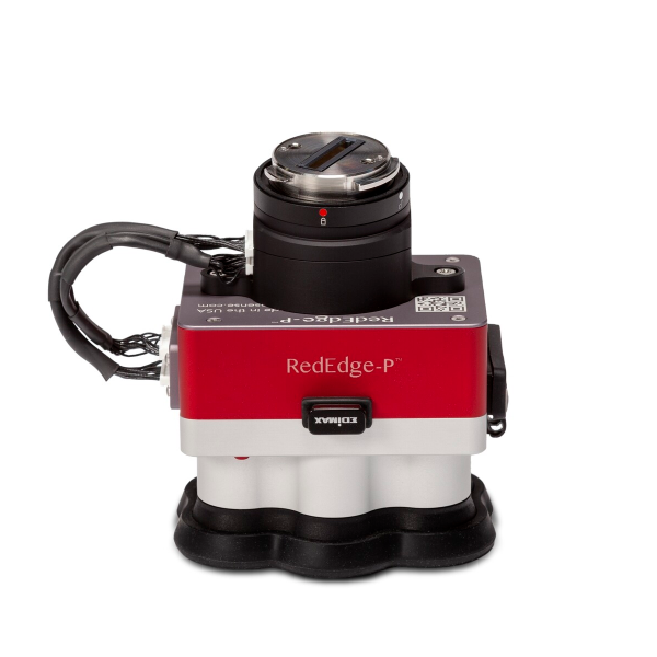
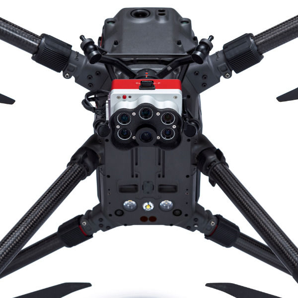
Micasense Rededge-P Multispectral Camera Kit + DJI Skyport For M300
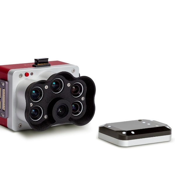
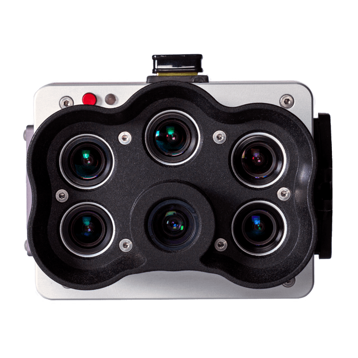
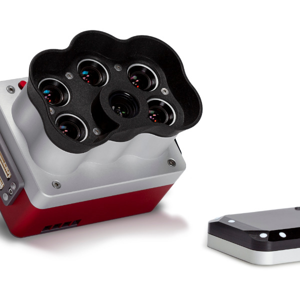
RedEdge-P uses purpose-built optics and industrial image sensors coupled with narrowband, scientific-grade filters. In addition, it undergoes a rigorous factory calibration process, creating a high-quality, calibrated, rugged tool for high-quality outputs.
Key Features
Increased Storage
New professional removable storage standard in CFexpress, enabling over two captures per second and the immediate turnaround time between flights by simply swapping cards.
Synchronised capture of high-res RGB and multispectral
Simultaneous capture of up to six bands, enabling multiple high-resolution outputs such as RGB, crop vigour indices (NDVI, NDRE, etc), and high resolution panchromatic.
Twice the spatial resolution of the previous RedEdge
With a high-resolution panchromatic imager, RedEdge-P enables higher-resolution RGB and multispectral outputs – 2cm resolution when flying at 60m. Spot smaller problems or features sooner and make more reliable management decisions across a variety of use cases.
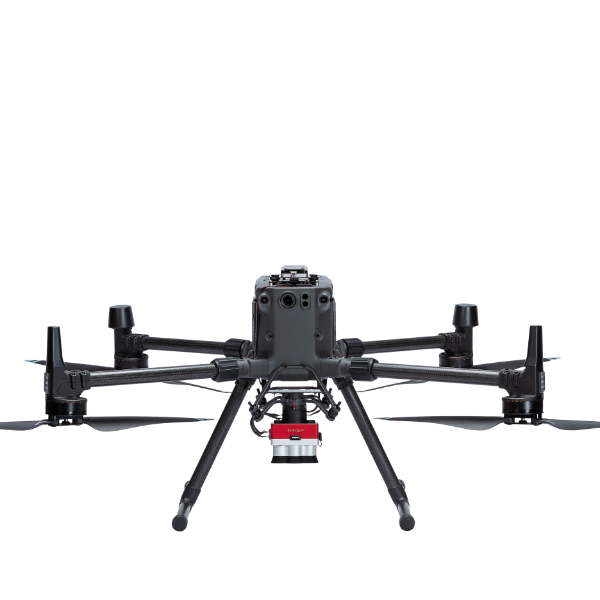
Works with what you have (drones, processing, flight planning)
This solution is compatible with a wide range of aircraft, from large, fixed wings to small multirotors. Flight planning and data processing can be done with industry-standard tools.
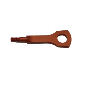
Rugged Design
IP4X rated for dust and splash protection
RedEdge-P vs RedEdge-MX
Data collected showing hay bales in the centre of a field, taken by the new RedEdge-P (left) and RedEdge-MX (right) sensors for comparison.
The industry standard multispectral sensor
Plant counting
Plant counting algorithms require high-resolution imagery. RedEdge-P combines a Panchromatic lens with 5-high-res multispectral lenses enabling high-res RGB and multispectral outputs, allowing plant count even at early growth stages.
Phenotyping
Manually measuring plant characteristics is time-consuming. RedEdge-P band combination enables high-resolution multispectral outputs, allowing the detection of variability at the leaf level.
Plant health mapping
RedEdge-P’s high-resolution multispectral outputs allow the generation of indices and composites to see individual chlorophyll levels in the plants and compare over time.
Fertiliser management
RedEdge-P’s high-res and accurate outputs allow easy identification of areas low in nutrients and help monitor the effects of fertiliser applications throughout the season and determine if, when, and where a new application is needed.
Disease identification
RedEdge-P captures a critical part of the light spectrum for studying plants (712–722 nm), called the red edge band. It is in this section of the spectrum that the first signs of stress start to show. Using analytics generated with the red edge band, it is possible to identify disease sooner and act faster to stop the spread.
Species differentiation
Some differences among species may not be visible to the naked eye. High-res multispectral data allows for species differentiation, weeds included, by highlighting characteristics such as chlorophyll content, vigour, and leaf size.
Advanced crop scouting
High-res multispectral and RGB imagery provides advanced field scouting capabilities. In one flight, it is possible to collect accurate and geotagged information of a problem, making it easy to assess the situation and determine the appropriate intervention.
High-res 3D point clouds
RedEdge-P’s 5.1-Megapixel panchromatic band provides over twice the ground resolution of the industry-standard RedEdge-MX, resulting in 3D point clouds with up to 4 times the point density.
The same narrow bands, at twice the resolution
This solution offers a seamless way to capture not just standard spectral bands but at a spatial resolution that takes it a step further. With a high-resolution panchromatic imager, RedEdge-P enables higher-resolution RGB and multispectral outputs – 2cm resolution when flying at 60m.
Calibrated multispectral imagery
CRP 2 – A new compact version of our Calibrated Reflectance Panel. Same functionality, now in a smaller size and easier to carry!
**Note: Each camera kit comes with the radiometric calibration tools you need to enable comparison over time.
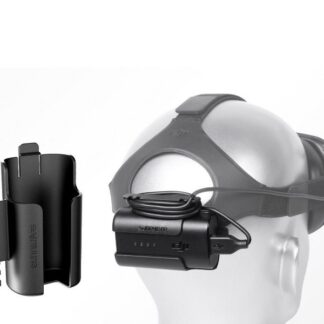
DLS 2 – Our next-generation light sensor, with cutting-edge technology for irradiance and sun angle measurements. It provides more accurate, reliable data, greatly reduces the need for post-processing, and substantially improves radiometric accuracy. With the integrated GPS, setup with any aircraft is simple.