Product Description
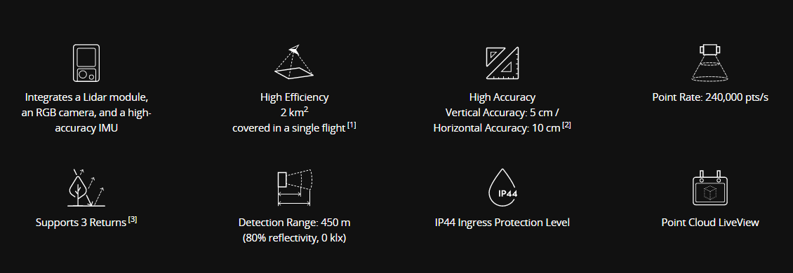
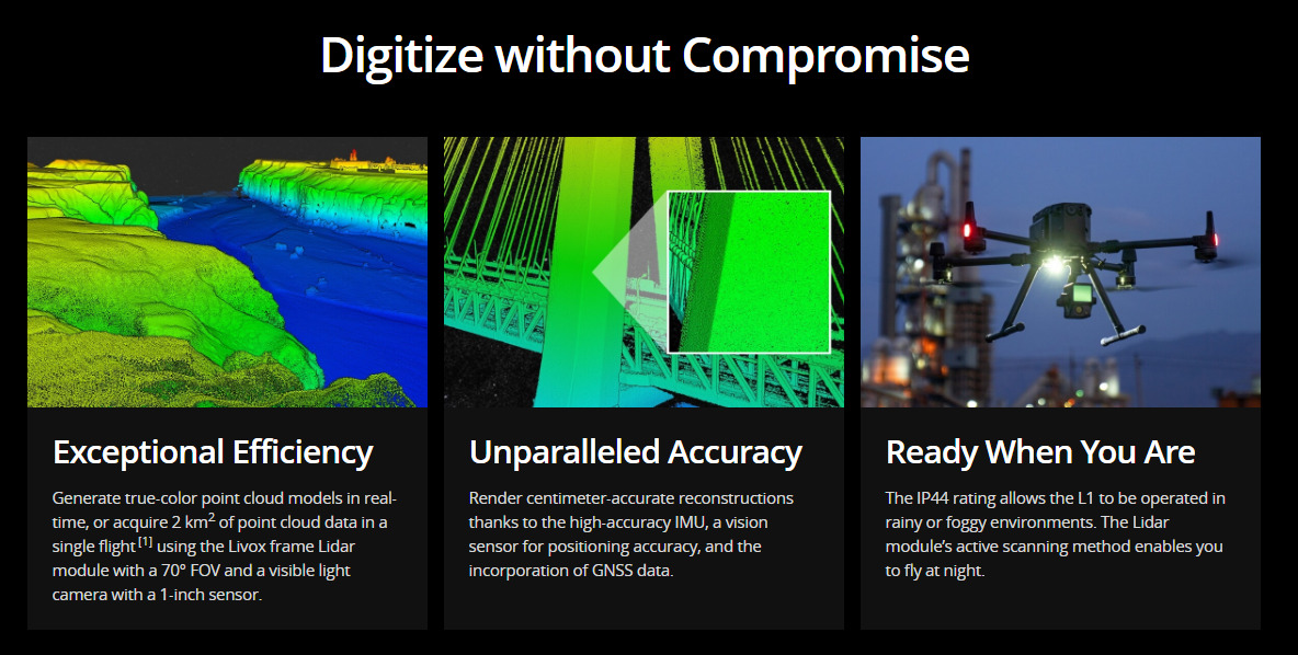
The Zenmuse L1 integrates a Livox Lidar module, a high-accuracy IMU, and a camera with a 1-inch CMOS on a 3-axis stabilized gimbal. When used with Matrice 300 RTK and DJI Terra, the L1 forms a complete solution that gives you real-time 3D data throughout the day, efficiently capturing the details of complex structures and delivering highly accurate reconstructed models.
Point Cloud LiveView
Real-time point clouds provide immediate insights onsite, so operators are informed to make critical decisions quickly.
You can also verify fieldwork quality by checking point cloud data immediately after each flight.
Measurement and Annotation
Acquire and communicate critical dimensions on the point cloud model using measurements and annotations.
General
Product Name
Zenmuse L1
Dimensions
152×110×169 mm
Weight
Approx. 900 g
Power
30 W
IP Rating
IP44
Supported Aircraft
Matrice 300 RTK
Operating Temperature Range
-20° to 50° C (-4° to 122° F)
Storage Temperature Range
-20° to 60° C (-4° to 140° F)
System Performance
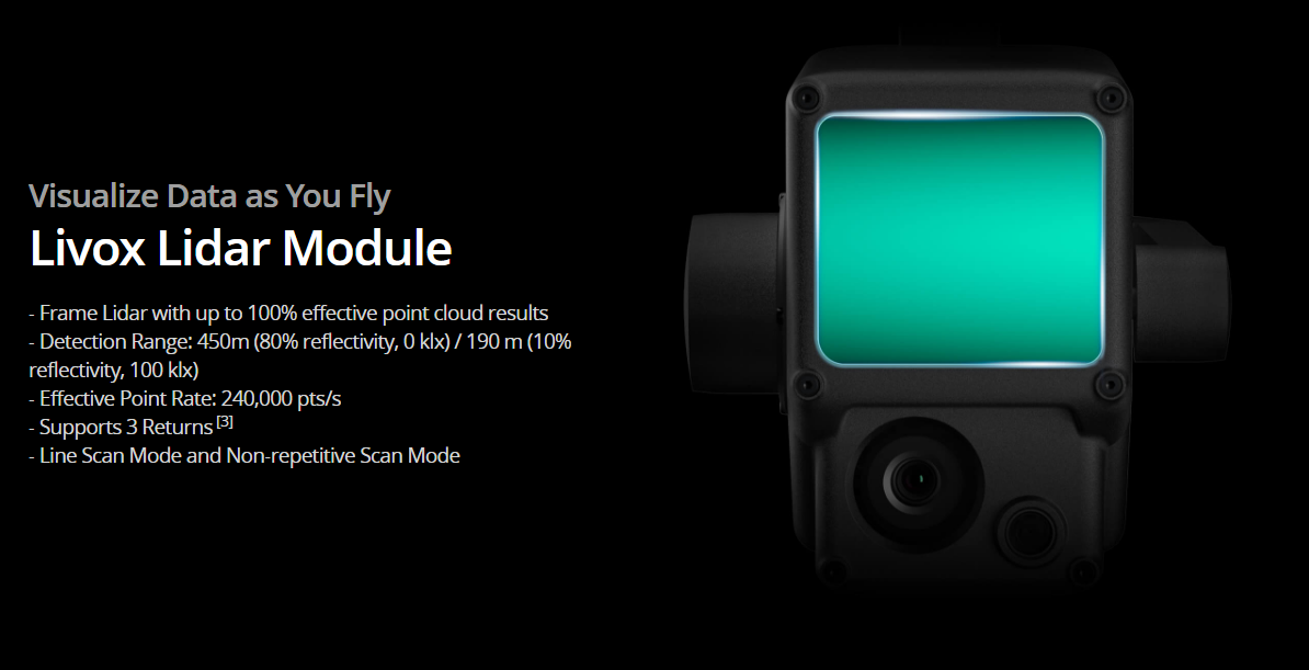
Detection Range
450 m @ 80% reflectivity, 0 klx;
190 m @ 10% reflectivity, 100 klx
Point Rate
Single return: 240,000 pts/s;
Multiple return: 480,000 pts/s
System Accuracy
Horizontal: 10 cm @ 50 m;
Vertical: 5 cm @ 50 m
Real-time Point Cloud Coloring Modes
True color; coloring by reflectivity; coloring by elevation
Lidar
Ranging Accuracy
3 cm @ 100 m
Maximum Returns Supported
3
Scan Modes
Repetitive line scan mode, non-repetitive petal scan mode
FOV
Repetitive line scan: 70.4°×4.5°;
Non-repetitive scan: 70.4°×77.2°
Laser Safety
Class 1
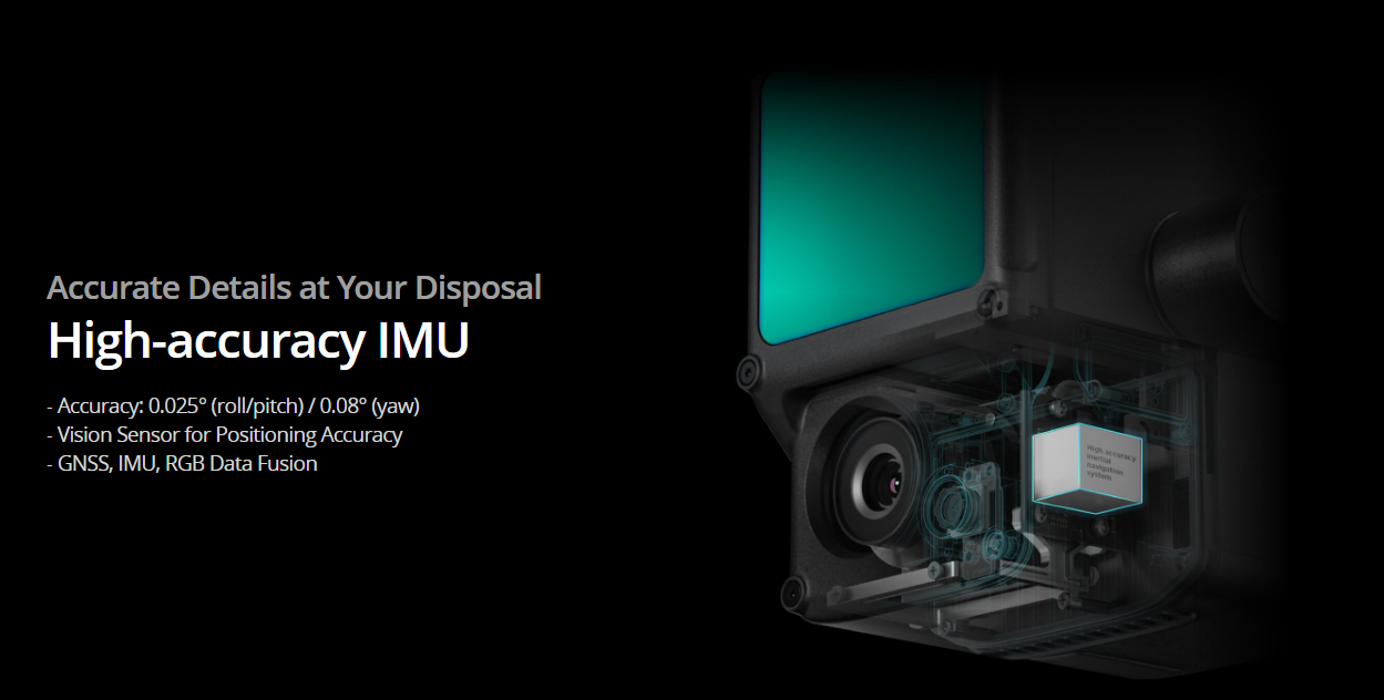
Inertial Navigation System
IMU Update Frequency
200 Hz
Accelerometer Range
±8 g
Angular Velocity Meter Range
±2000 dps
Yaw Accuracy
Real-time: 0.18°, Post-processing: 0.08°
Pitch / Roll Accuracy
Real-time: 0.03°, Post-processing: 0.025°
Auxiliary Positioning Vision Sensor
Resolution
1280×960
FOV
95°
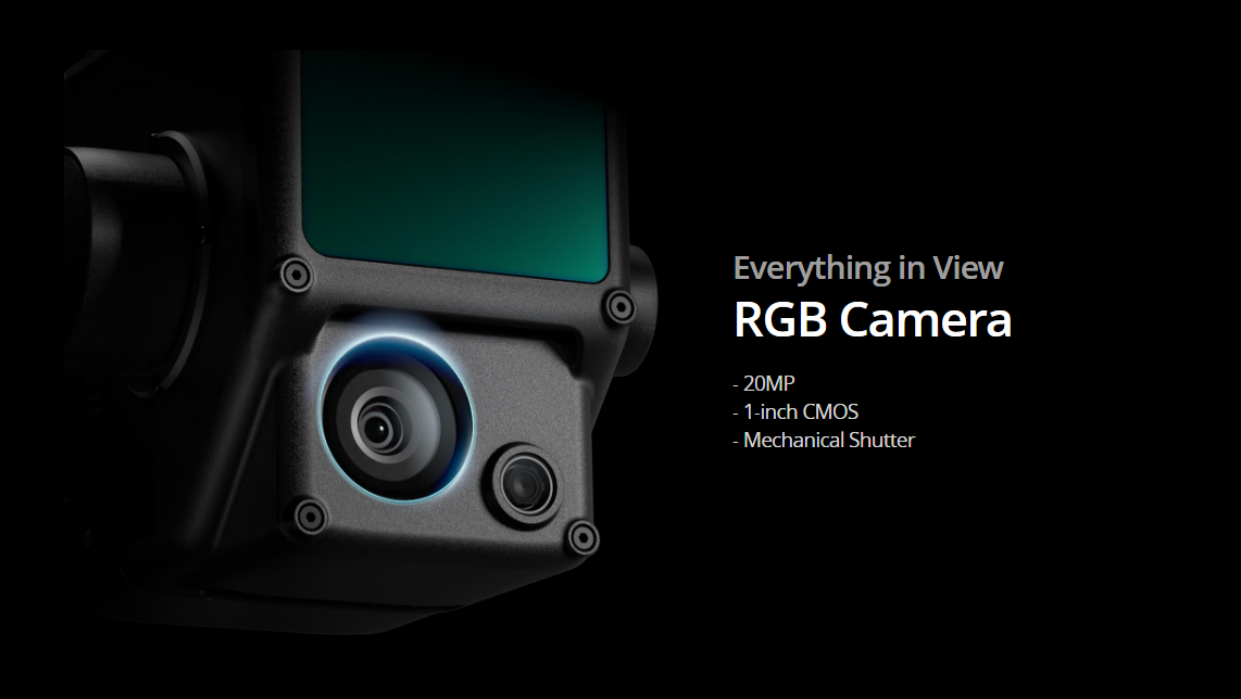
RGB Mapping Camera
Sensor Size
1 inch
Effective Pixels
20 MP
Photo Size
4864×3648 (4:3); 5472×3648 (3:2)
Focal Length
8.8 mm / 24 mm (Equivalent)
Shutter Speed
Mechanical Shutter Speed: 1/2000 – 8 s
Electronic Shutter Speed: 1/8000 – 8 s
ISO
Video: 100 – 3200 (Auto), 100 – 6400 (Manual)
Photo: 100 – 3200 (Auto), 100 – 12800 (Manual)
Aperture Range
f/2.8 – f/11
Gimbal
Stabilized System
3-axis (tilt, roll, pan)
Angular Vibration Range
0.01°
Mount
Detachable DJI SKYPORT
Mechanical Range
Tilt: -120° to +30°; Pan: ±320°
Operation Modes
Follow/Free/Re-center
Data Storage
Raw Data Storage
Photo/IMU/Point cloud data storage
Point Cloud Data Storage
Real-time modeling data storage
Supported microSD Cards
microSD: Class 10 or UHS-1 rating or above; Max capacity: 256 GB
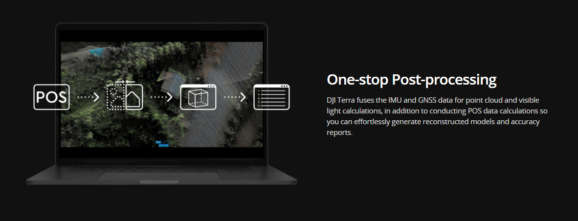
Post-processing Software
Supported Software
DJI Terra
Data Format
DJI Terra supports exporting standard format point cloud models:
Point cloud format: PNTS/LAS/PLY/PCD/S3MB format
Reconstruction model format: B3DM/OSGB/PLY/OBJ/S3MB format